
数字平台模块
将复杂地形转化为可管理、可操作的数字环境——把厘米级三维底座、AI 识别结果与多源监测数据汇聚到同一视图,是保护地科学决策的数字化基础。
数字孪生保护地四层架构
通过四层架构完成从生态现场数据采集、AI 分析、数字孪生推演到管理决策的全链路闭环。
生物感知监测层
聚焦动植物与微生物全维监测,构建物种动态清单。
依托智能影像识别、声学监测阵列与 eDNA 环境采样技术底座。
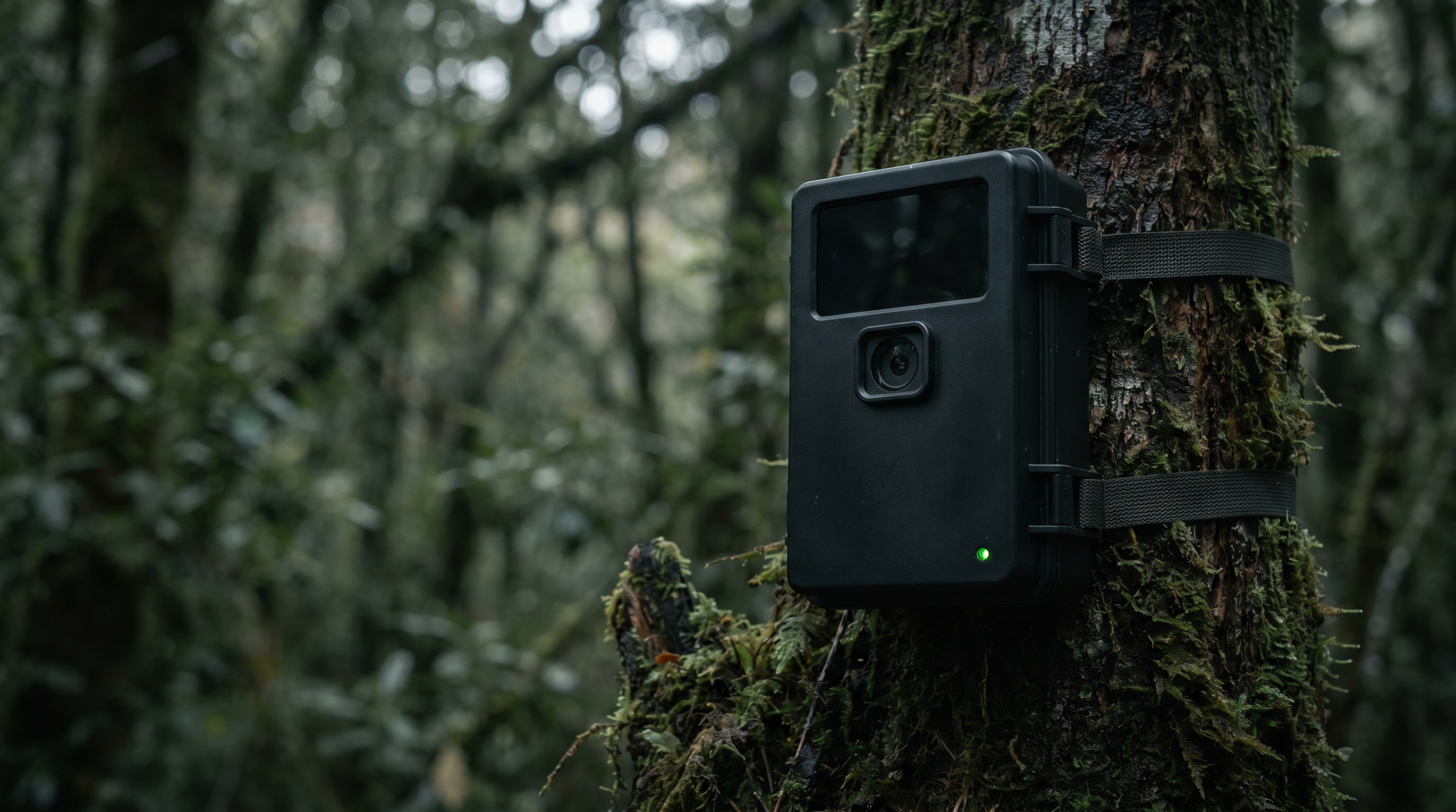
陆生脊椎动物全维追踪
融合红外相机、声学阵列与 GPS 项圈,实现全天候行为动态捕捉。
水生生态物种精准识别
利用 eDNA 环境 DNA 指纹技术结合水下视觉 AI,构建水生生物清单库。
植被立体结构健康诊断
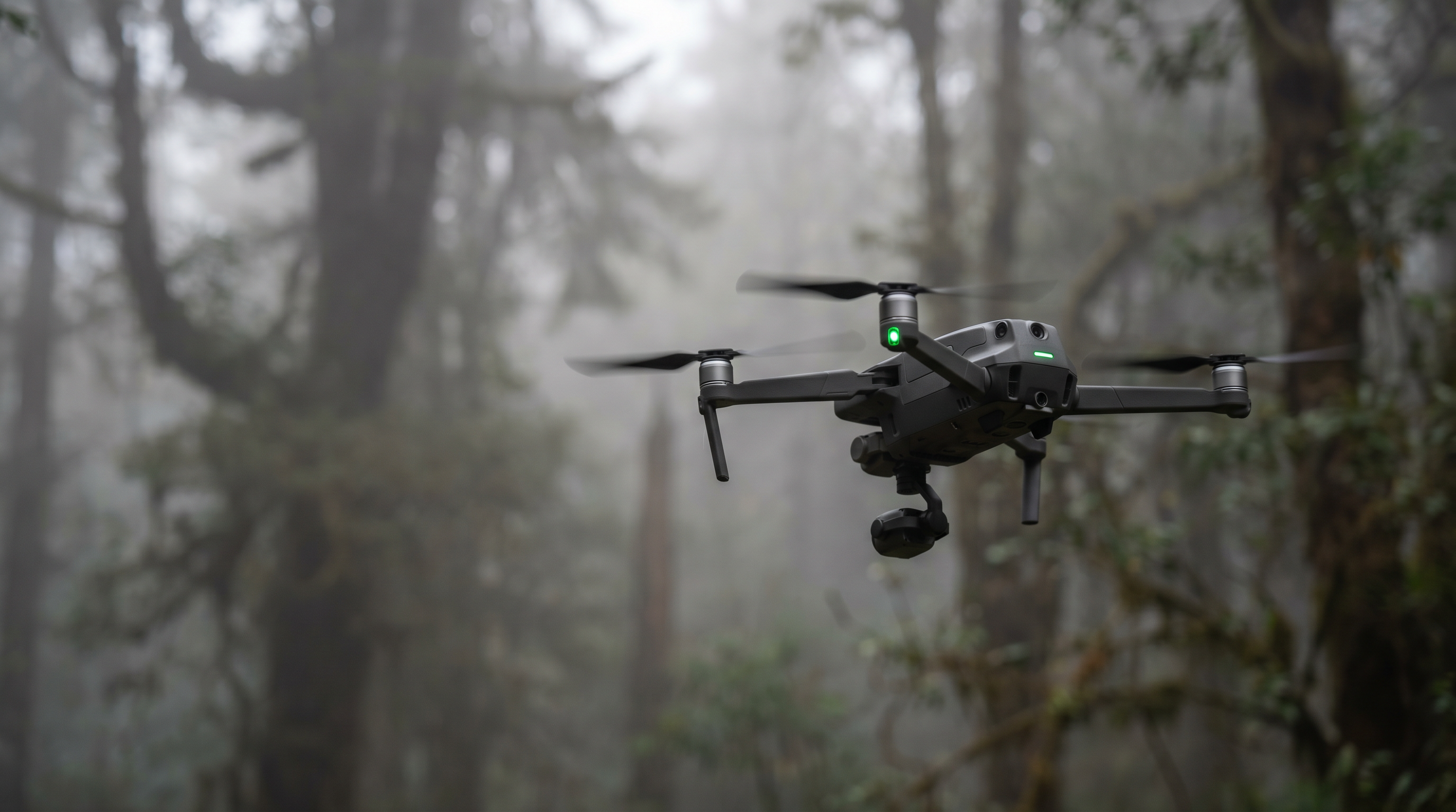
无人机 LiDAR 激光雷达重构三维骨架,多光谱影像反演大面积植被长势。
微生态关键功能群监测
智能诱捕器量化传粉昆虫群落,长期追踪分解者微生物群落演替规律。

环境多要素感知层
覆盖局地小气候、土壤理化性质与水文水质的全天候采集。
集成自动气象站、多参数传感器网络与 GNSS 时空定位技术体系。
全域气象链条感知
部署自动气象站与可燃物湿度传感器,构建从大气驱动到地表火险的全链路数据推演模型。
根区微环境动态诊断
利用水热盐三合一及 pH 传感器,实时捕捉植物根区微环境变化,精准量化植被生长胁迫因子。
水文与水资源多尺度智控
融合雷达水位计与多参数水质探头,实现从流域洪水演进预警到水体富营养化风险的多维感知。
碳收支闭环与地质毫米级安防
构建“存量 + 通量”碳循环核算体系,结合 GNSS 位移监测,筑牢生态双碳与地质灾害安全防线。
人类活动智能管控层
精细化管控人为干扰与巡护轨迹,实时输出通行记录与违规智能报警。
核心能力包括 AI 视频周界防护与移动巡护作业终端。
全流程自动化管控
构建“入口抓拍-高点巡航-轨迹追踪-报警派单”闭环,实现对人员、车辆及船只的全域智能自动化管控。
多维全天候无感感知
融合水面雷达、AIS 接收机与声学监测仪,打破单一维度限制,实现对保护地水域和陆域的无死角、全天候实时监控。
AI 极速应急响应引擎
利用 AI 高点智能视频监控算法,对森林烟火、违规入侵等风险进行毫秒级特征识别,实现突发事件的秒级发现与快速预警。
业务管理全链路闭环
移动端巡护 APP 与后端智能预警工单系统深度联动,构建“自动报警-智能派单-现场处置-结果反馈”的全流程数字化管理闭环。

全维智能计算中枢层
实现多源异构数据深度融合与模型推演,生成全域三维可视化看板与智能处置工单。
依托大数据中台与数字孪生引擎算力支撑。
全域多源数据深度融合治理
统一全时空地理基准,智能清洗异构数据,构建生态环境可靠分析输入底座。
多维 AI 并行智能自动解译识别
部署图像、声纹及点云 AI 模型矩阵,实时提取珍稀物种、火情隐患等关键结构化信息。
生态专业机理模型集成推演预测
耦合碳汇核算、火险蔓延及珊瑚白化模型,对生态系统演变趋势进行长周期深度研判。
全场景数字孪生空间动态全景映射
构建高保真三维沉浸式场景,叠加实时监测数据流,支持任意历史回溯与管控预案模拟沙盘。
智能规则驱动闭环协同响应处置
多维阈值自动触发分级预警,结合巡护力量时空分布动态派单,实现事件秒级响应闭环。
工作流程图
生物层数据
Biology
环境层数据
Environment
人类活动层数据
Human Activity
AI Analysis
数据融合与 AI 分析
多源异构数据深度治理
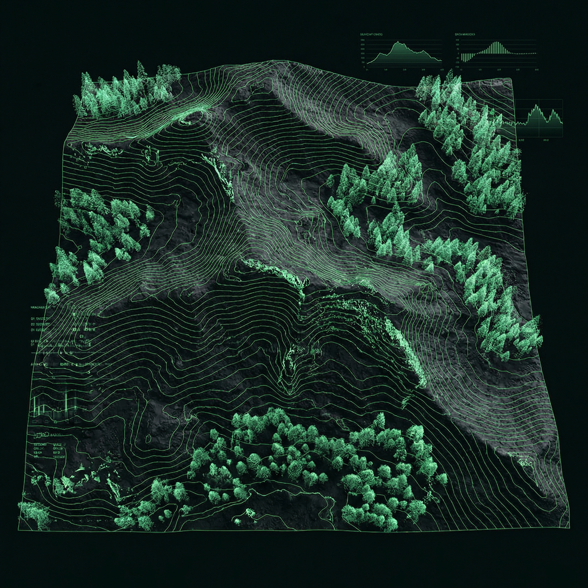
数字孪生底座-厘米级三维建模
采用无人机正摄与倾斜摄影融合采集模式,通过多角度拍摄全面获取地形信息。 经过影像拼接、点云重建与表面优化处理,生成精度达厘米级的三维数字地形模型, 在虚拟空间中精准还原地貌特征与生态结构。
建模精度
厘米级
采集模式
正摄 + 倾斜
数据处理
全自动
应用场景
巡护路线规划
基于高精度三维地形,科学规划巡护路线,减少盲区覆盖,提升巡护效率与安全性。
生态评估
利用三维模型进行植被覆盖分析、生境评估和生态廊道识别,为保护策略提供数据支撑。
植被恢复监测
通过多期三维模型对比,精确监测植被恢复进程,量化评估修复效果。
灾害模拟与预警
在数字地形上模拟火灾、山洪、泥石流等自然灾害路径,提前制定应急预案和避险方案。
山思数字孪生保护地管理系统
全维度立体感知覆盖
打通生物多样性、环境因子与人类活动数据壁垒,构建全域全息生态认知图谱。
端到端全链路智能闭环
实现从边缘端实时数据清洗采集到云端智能研判预警派单的全流程高度自动化流转。
数字孪生赋能科学决策
基于长期时序生态模型推演,将监测数据转化为可量化的保护修复成效评估与管理建议。
多场景生态灵活适配架构
轻量化模块化设计,可快速适配森林、湿地、海洋等不同类型生态系统的差异化部署需求。